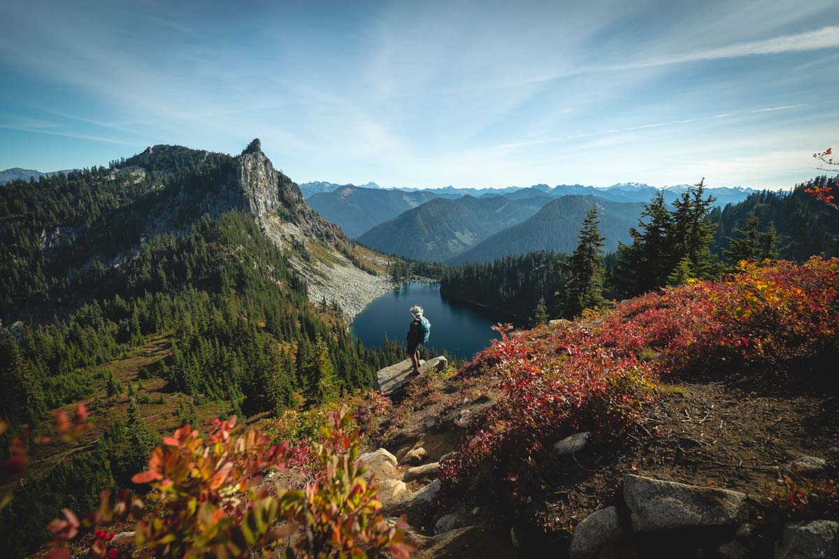
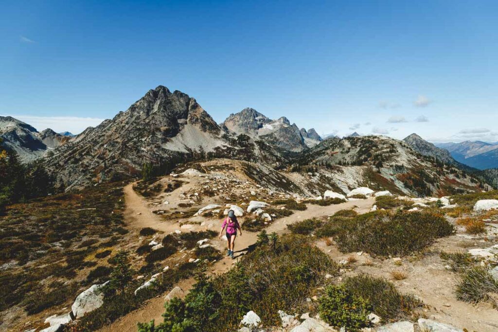
25 EPIC Hikes in Washington to Tackle
It’s no secret that the hiking trails in Washington are some of the best in the nation. Whether you’re looking for a challenging route with epic views or just an easy trek you can conquer in a few hours, you’ll have hundreds of options.
From craggy coastline trails and lovely lakeside paths to technical mountain summits and lush rainforest rambles, the possibilities are truly endless when it comes to hiking in Washington.
While the list is endless, below, you’ll find 25 of the absolute best hikes in Washington.
25 EPIC Hikes in Washington State
Below you’ll find our absolute favorite hikes in the state. From all corners of Washington, high and low, easy and hard… These hikes are the ones we LOVE and that we personally recommend.
We’ve divvied them up for you by area so you can plan your hikes around Washington accordingly!

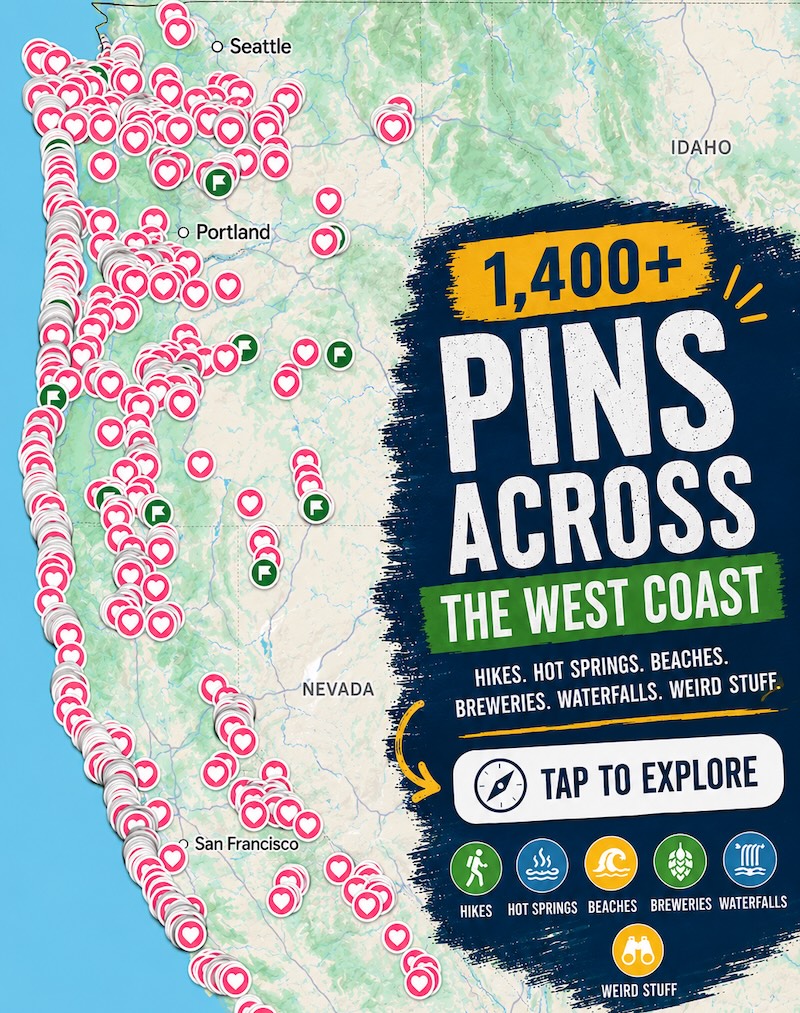
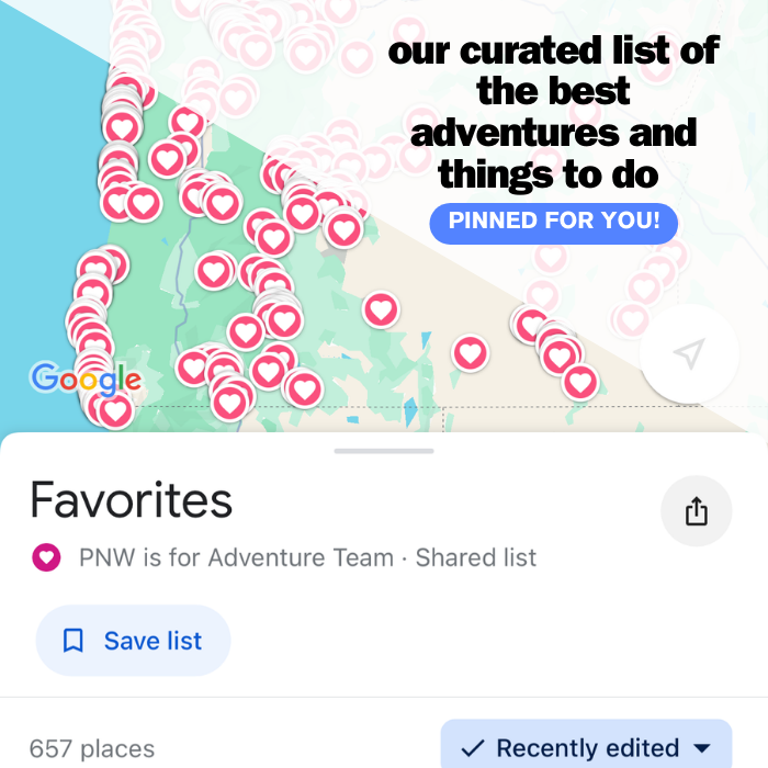
📍 GET THE ULTIMATE PNW MAP 🗺️
Get our curated list of the best adventures, things to do, and places to grab a brew loaded onto your maps with just two clicks!
✅ Waterfalls ✅ Hikes ✅ Viewpoints
✅ Craft breweries ✅ National Parks ✅ 1400+ Pins


Hikes Near Seattle Washington
1. Cape Deception Park
Distance: 4.7 miles
Type of Trail: Loop
Difficulty: Moderate
Pass: Discovery Pass
Cape Deception Park is home to some of the best hiking trails in Washington. While there are numerous routes to choose from if you’re looking to get the most out of your hike, check out Lighthouse Point and Lottie Point via the Rosario Head Trail.
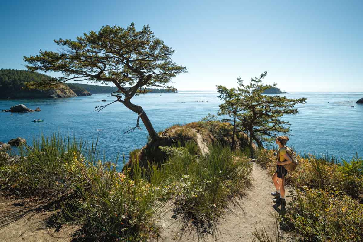
This moderate loop trail will lead you along rolling hills, and you’ll find scenic views of the water peeking out behind the trees as you walk. All but the most inexperienced hikers will find the route relatively easy.
However, if you find yourself out of breath, there are plenty of places to take a break along this trail.
While you catch your breath, you can admire the carpets of wildflowers that inhabit the area around the path. If you’re lucky, you may even spot some birds in the trees or seals basking along the rugged shoreline below.
While this is one of the best hikes in Washington, the signage can be a bit confusing if you’re hiking it for the first time. Luckily, the area is relatively small, so you should have no trouble finding your way if you do happen to get turned around.
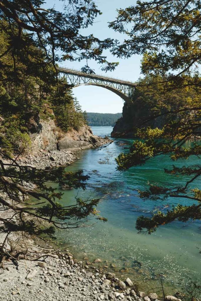
READ MORE: Wandering Deception Pass State Park
2. Fort Ebey State Park
Distance: 1.2 miles
Type of Trail: Out & Back
Difficulty: Easy
Pass: Discovery Pass
Some of the best and most beautiful hiking trails in Washington are located inside Fort Ebey State Park, including a 1,200-mile Pacific Northwest Trail segment.
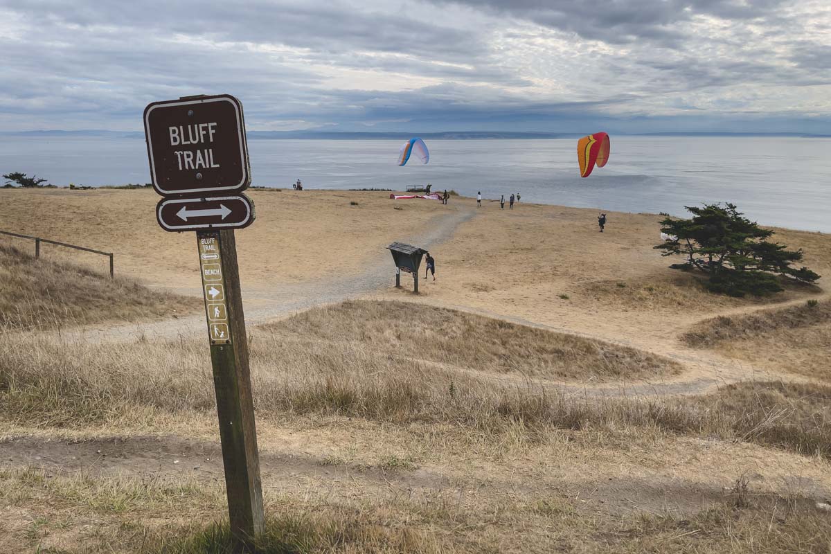
If you’re looking for something a little more doable in a single afternoon, don’t miss the Fort Ebey Bluff Trail.
This moderate out-and-back trek is suitable for both novices and seasoned hikers, and at just over 1-mile in length, you’ll have no problem completing it in a timely fashion.
Stroll past epic ocean vistas or stop and explore the old bunkers that line the trail. You’ll also encounter verdant vegetation along the steep bluffs, and the observant hiker may even spot bald eagles nesting in the trees above.

With an abundance of glorious views and a relatively short trail length, this route sees a lot of traffic during the summer months. But, after all, it is one of the best hikes in Washington. So if you’re looking to beat the crowds and have this slice of paradise to yourself, be sure to arrive early in the morning.
READ MORE: Exploring Fort Ebey State Park on Whidbey Island
3. Franklin Falls
Distance: 2.0 miles
Type of Trail: Out & Back
Difficulty: Easy
Pass: Northwest Forest Pass
Seattlites will be happy to learn that one of the best hikes in Washington can be found less than 30 miles away from the city center.
Situated in the lush Snoqualmie Pass, Franklin Falls Trail is the perfect route for those on the hunt for a peaceful stroll in nature. This short and sweet route is especially popular with families, dog owners, and those who are short on time.

The trail is open year-round, and you’ll find that hiking it in different seasons makes it feel like an entirely new trail.
On hot summer days, you can dip your toes in the water as you admire the falls for which the route was named. During the winter months, the snow dusting the trees and trail makes for a magical experience.
READ MORE: Franklin Falls Hike
🏨 Need a place to crash nearby?
From rustic cabins to boutique inns—check prices and availability in just a click.
4. Snoqualmie Falls
Distance: 1.4 miles
Type of Trail: Out & Back
Difficulty: Easy
It’s entirely possible to find breathtaking views that won’t leave you short of breath along the hiking trails in Washington, and the Snoqualmie Falls is an easy trek for hikers of all skill levels.
There are a few small hills along the way, but the minimum effort it takes to ascend them will be worth it once you lay eyes on the thundering Snoqualmie Falls.
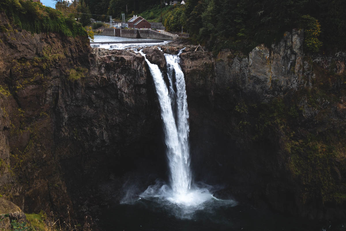
As you hike to the viewing point of the falls, you’ll be surrounded by lush vegetation and some informational signage. The trek back up from the vantage point is admittedly more cumbersome but still doable for even the most inept hikers.
You’ll find free parking right in front of the trailhead, though this area does fill up quickly on weekends. That’s not surprising, though, since it’s the best waterfall near Seattle.
READ MORE: Snoqualmie Falls Hike
5. Rattlesnake Ledge Trail
Distance: 5.3 miles
Type of Trail: Out & Back
Difficulty: Moderate
Epic views, excellent trail conditions, and a location close to Seattle make the Rattlesnake Ledge Trail one of the best hikes in Washington.
The trail is considered a classic amongst locals, and the title is well deserved. As you conquer the switchbacks, you’ll find three different ledges, each with a better vantage than the last.
You’ll reach the lower ledge first, and from here, you’ll be treated to panoramic views of Mount Sai, Mount Washington, and Rattlesnake Lake below. The views get better and better as you climb, and the crowds also tend to thin out – win-win!
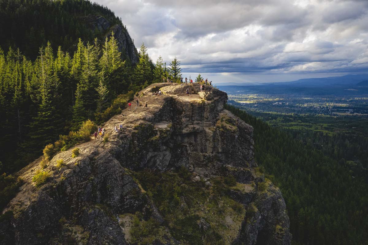
In addition, this trail is shorter and has less elevation gain than other trails in the state with similar views, making it a no-brainer for those in search of the most beautiful hiking trails in Washington.
If you can’t get enough of the views, continue hiking along the ridge or head back down to Rattlesnake Lake for a refreshing dip in the water.
6. Wallace Falls via Woody Trail
Distance: 5.5 miles
Type of Trail: Out & Back
Difficulty: Moderate
Pass: Discovery Pass
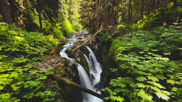
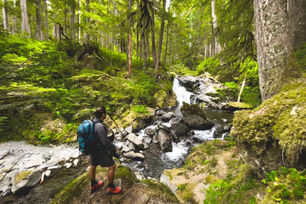
Hiking Woody Trail is all about chasing waterfalls. This much-loved route boasts no less than nine waterfalls along the gushing Wallace River, in addition to splendid forest views along the entire trail.
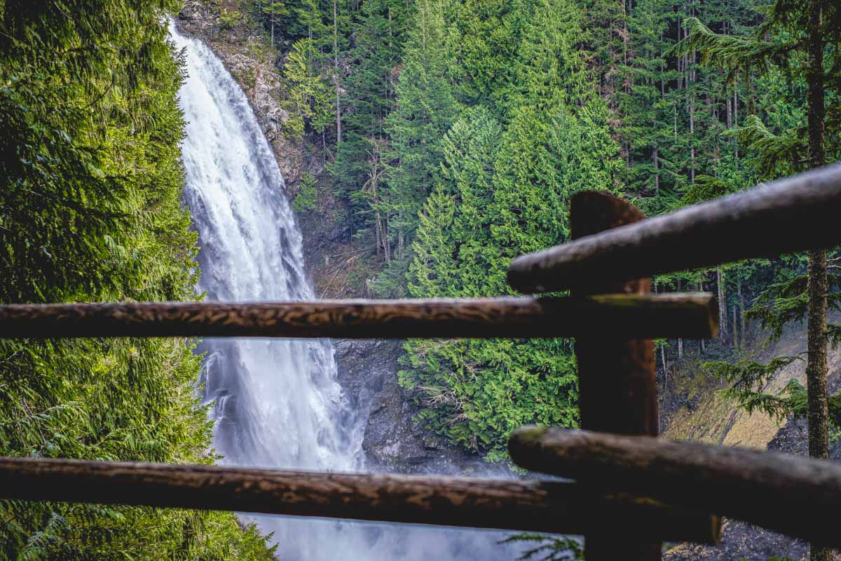
The falls are categorized into three different sections (lower, middle, and upper), and if you get tired at any point, it’s not uncommon to cut the hike short and head back the way you came. The best views can be seen from the middle falls, anyhow!
Woody Trail is one of the most popular hiking trails in Washington, so be sure to arrive plenty early if you’d like to have this beautiful route all to yourself.
RELATED: 7 Awesome Waterfalls Near Seattle, Washington
Washington Hikes Near The Columbia River Gorge
7. Lacamas Park Hike
Distance: 2.9 miles
Type of Trail: Loop
Difficulty: Easy
Blessed with a labyrinth of interconnecting trails, Lacamas Park is a hidden oasis just outside of the hustle and bustle of the Vancouver and Portland city centers.
As a result, this 312-acre park often flies under the radar, making it the perfect place to come and unwind amid unspoiled nature.
You’ll have some of the best hikes in Washington at your disposal, leading you past peaceful forests, beautiful lakes and streams, and colorful carpets of wildflowers if you’re visiting in the sunny season.
Most routes are relatively easy to conquer in a short amount of time, and those looking for an extensive hike can connect trails for an extended expedition.
If you have time for just one, don’t miss the Lake to Lake Trail. You’ll get to take in views of Round Lake and Woodburn Falls as you meander the trail, and the diverse terrain and lush scenery will keep you entertained throughout the entire hike.
READ MORE: Your Guide to Lacamas Park
🕒 Save hours of planning time! ⛰️
📍 Get The Ultimate West Coast Map
1400+ breweries, trails, waterfalls, beaches, and weird roadside stops—mapped for you!
8. Dog Mountain
Distance: 6.5 miles
Type of Trail: Loop
Difficulty: Hard
Experienced hikers looking for a real leg burner should make a beeline to Dog Mountain. With an elevation gain of nearly 3,000 feet, this intense Washington hiking trail is one for only the most seasoned trailblazers (our calves were burning!).
As you climb, you’ll feel the climate switch from hot and arid to the quintessential cool mists of the Pacific Northwest, so be sure to dress in layers no matter what time of year you are hiking.

You’ll be spoiled with views of massive moss-covered trees, floral meadows, and soaring mountain peaks as you make your ascent, and those that make it to the summit will be rewarded with unmatched views of the Columbia River Gorge below.
Consider arriving early, as the parking lot fills up fast. You will need to pay a fee to park, and if you’re visiting on a weekend during peak wildflower season in the spring, you will need a permit to hike. This is our favorite hike in Washington in spring!
9. Hamilton Mountain
Distance: 6.4 miles
Type of Trail: Out & Back
Difficulty: Moderate
Pass: Discovery Pass
Steep switchbacks are a constant on Hamilton Mountain Trail, but luckily, so are the incredible views.
Admittedly, there are no jaw-dropping views from the summit overlook. Instead, hikers can look forward to stunning vistas of the valley during their entire ascent of the trail.
Some of the best views can be seen about two miles in, so if you’re not interested in scrambling up the entire trail, this is a great turnaround point.
However, if you do press on to the summit, you’ll pass by verdant forests, winding rivers, and even access to a lovely waterfall.
The mosquitos love this popular Washington hiking trail just as much as humans do, so be sure to bring plenty of bug spray along with you.
If you arrive early in the morning, you’ll have no problem finding a parking spot. We had this hike almost to ourselves when we went!
10. Beacon Rock Trail
Distance: 1.5 miles
Type of Trail: Out & Back
Difficulty: Moderate
Pass: Discovery Pass
What’s more exhilarating than climbing up the side of an ancient volcano? Beacon Rock Trail is impressive in more ways than one, and you’ll find unmatched views of the Columbia River Gorge as you hike up this breathtaking trail.
While the trail is steep, it’s a reasonably straightforward climb without any technical aspects. As a result, hikers of all skill levels will find this scenic trail enjoyable, even if it is a bit of a workout.
Composed chiefly of switchbacks made of wooden boards, you may need to take more than a few breaks along this trail. Luckily, the views are impressive the whole way, so you likely won’t mind stopping to take it all in.
Beacon Rock Trail is one of the best hikes in Washington, and therefore a popular one. For this reason, try to arrive early in the morning.
Hikes in Washinton’s Mount Rainier National Park
Everyone entering Mount Rainier National Park must pay an entrance fee. You can purchase a pass ahead of time or pay when you enter the park.
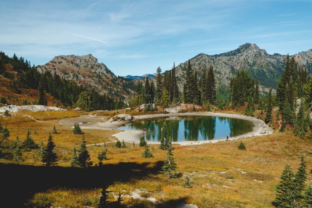
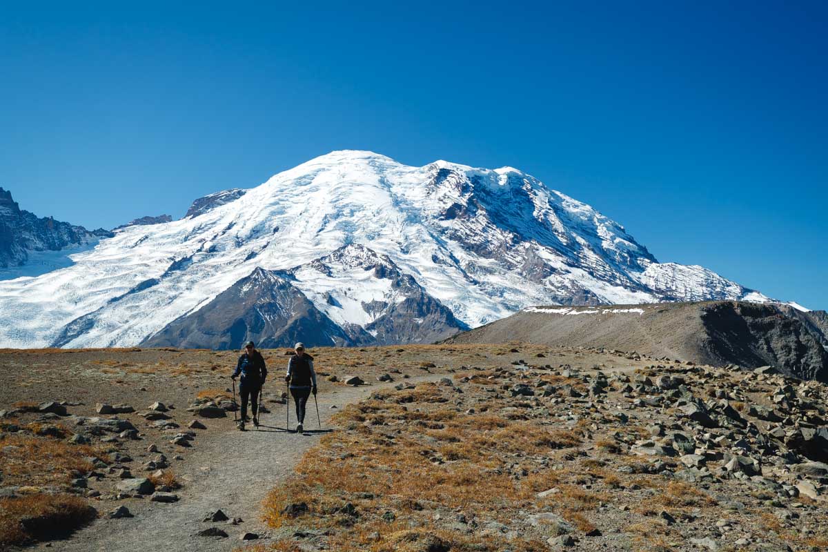
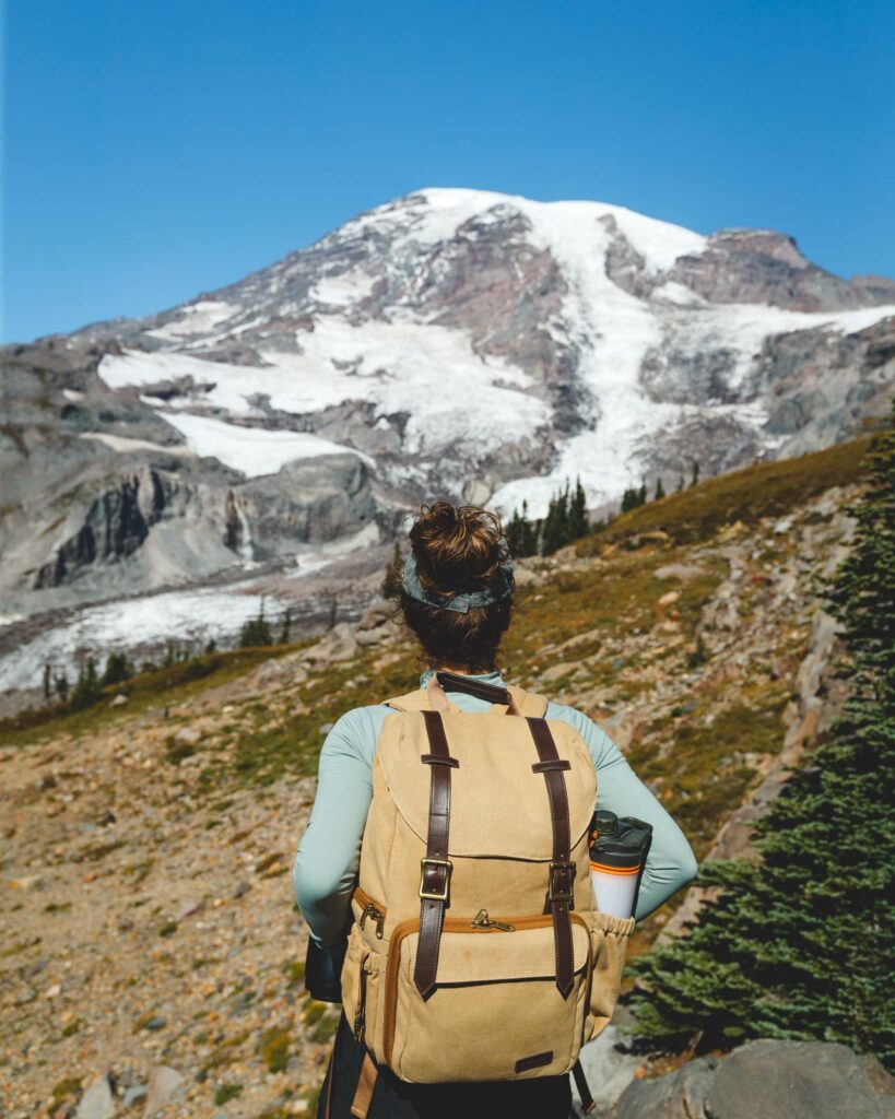
11. Naches Peak Loop Trail
Distance: 3.3. miles
Type of Trail: Loop
Difficulty: Moderate
Pull into the big lot near Tipsoo Lake and make your way to the trailhead near the picnic area towards Chinook Pass. You can ascend this loop trail in either direction, but we think the best views will be found going clockwise.
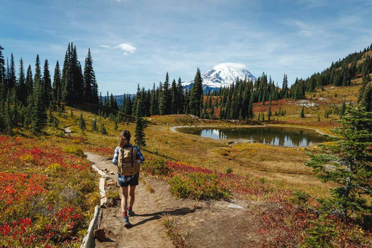
On clear days, the snow-capped peak of Mount Rainier highlights this much-loved Washington hiking trail, though if you visit in the autumn, the vibrant fall foliage is a close second. However, no matter what time of year you visit, the valley views along the trail will not disappoint.
The inclines are gradual, making the 636-foot elevation gain a breeze. That being said, if you’re hiking in the early morning or towards the end of the season, you may need to look out for slippery sections of the trail caused by snowfall and ice.
BONUS: If you want to add on a couple of miles and get stunning views of a lesser-visited area, take the detour to Dewey Lake!
READ MORE: Hiking Naches Peak Loop Trail
12. Fremont Lookout Trail
Distance: 5.7 miles
Type of Trail: Out & Back
Difficulty: Moderate
This scenic trail is one of the best hikes in Washington, and the trailhead starts at the beautiful Sunrise Visitor Center ranger station.
At the start of the path, grassy meadows and colorful wildflowers make up much of the landscape. As you meander further along the trail, you’ll encounter a frozen lake, rows of towering pines, and maybe even a few mountain goats.
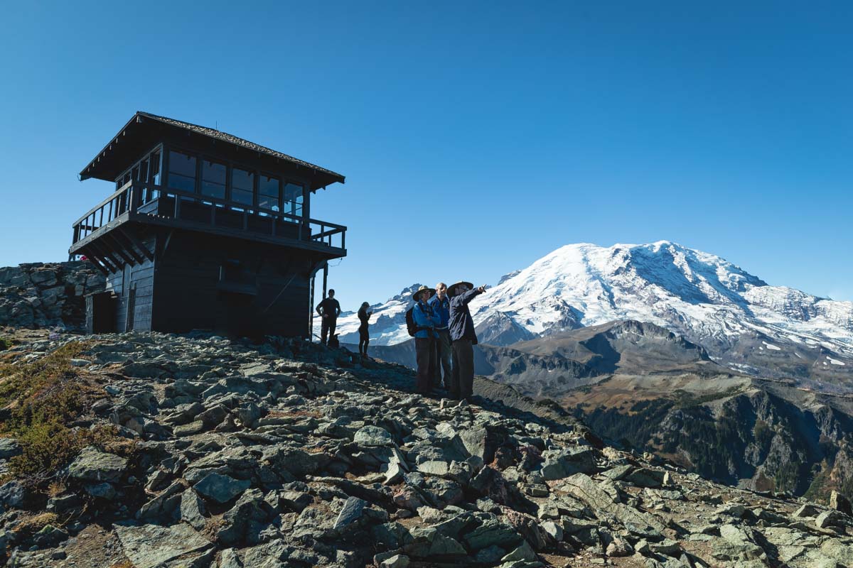
The higher you climb, the sparser the vegetation becomes, opening up the landscape for unmatched views of the mighty Mount Rainier. The summit is also home to one of just four remaining fire lookouts in Mount Rainier National Park.
This historical structure is precariously perched on a 7,000-foot cliff and is the highest one in the park.
So on a clear day, take your time soaking in the views or enjoying your lunch from this iconic vantage point. Just be sure to look out for hungry chipmunks! They were trying to steal our snacks.
If you’re hiking in the fall, you’ll likely encounter some snow and ice, so be sure to dress in lots of layers and bring your micro-spikes to conquer the last part of the trail.
The last mile or so of the trail is just very loose rock etched out of the side of a cliffside, so take care and watch your footing.
The road leading to the trailhead (Sunrise Road) is subject to seasonal closure, so be sure to check the road status before heading out.
READ MORE: Hiking the Mount Fremont Lookout Trail
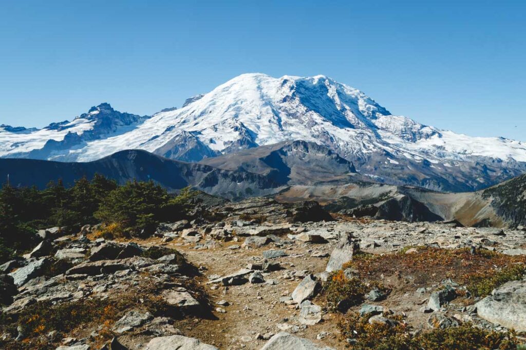
13. Burroughs Mountain Trail
Distance: 8.9 miles
Type of Trail: Out & Back
Difficulty: Moderate
If you’re looking for a vista-packed hike around Mount Rainier, the Burroughs Mountain Trail is the way to go. This is one of the most scenic hiking trails in Washington, especially on clear sunny days.
This trail is comprised of three “Burroughs,” named for the naturalist John Burroughs. These breathtaking vantage points are the highlight of the hike, though with a nearly 2,500-foot elevation change, conquering all three is no easy feat.
Most of the elevation change is located between the second and third Burroughs, and if you have any extra gas in the tank, the spectacular views of Mount Rainier are well worth the extra push.
The last Burrough will get you pretty darn close to the impressive glaciers sloping off Mount Rainier, it’s incredible!
The trailhead is located off of Sunrise Road, which is subject to seasonal closure. Before heading out, be sure to check the road status.
READ MORE: Hiking Burroughs Mountain Trail
14. Skyline Trail
Distance: 6.2 miles
Type of Trail: Loop
Difficulty: Hard
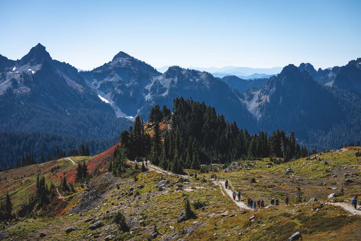
Skyline Trail is perhaps the most famous route inside Mount Rainier National Park, and it is undoubtedly one of the best hikes in Washington.
Verdant meadows, gigantic glaciers, and thundering waterfalls are just part of what awaits you on this challenging loop, and you can also look forward to panoramic views of the breathtaking Mount Rainier.
Take the trail clockwise for steady inclines and the best views of Mount Rainier. You’ll get the challenging portions of the path out of the way right at the beginning and have a relatively moderate hike the rest of the way.
You can veer off at the Golden Gate Trail to cut about a mile and a half off of the hike without missing much.
This Washington hiking trail is at its best between July and October when the colorful wildflowers and fall foliage put on a spectacular performance.
Hiking with the winter snow adds a layer of enchantment to this route, making the already tricky trail a lot more challenging. Once September hits, make sure you dress in warm layers.
READ MORE: How to Hike the Skyline Loop Trail
Hikes Around Leavenworth, Washington
15. Lake Valhalla and Mount McCausland
Distance: 8 miles
Type of Trail: Out & Back
Difficulty: Moderate
Pass: Northwest Forest Pass
Conquer two of the best hikes in Washington in one go with the Lake Valhalla and Mount McCausland trails.
Start your hike at the Smithbrook trailhead, then turn left onto the Pacific Crest Trail. You’ll need to hike about 2.6 miles to reach the Mount McCausland trailhead, which will be on your right but is unmarked.
The trail starts relatively flat and easy-going, but the further you hike, the steeper it gets.
The last half mile is the most challenging of the entire hike, and rather than making the arduous trek up to the summit of Mount McCausland, you can opt to just take the scenic detour down to Lake Valhalla if you’re not up for it.
However, we think the trek up Mount McCausland is 100% worth it!
The lake boasts a sandy beach area, which is perfect for taking in the stunning views of the mountains beyond.
On warm days you can take a dip in the crystal clear waters of the icy lake, and in the autumn, you’d be hard-pressed to find a better place to see the PNW fall colors.
Bug spray is a must in the summertime, and you won’t want to be without waterproof boots if you’re hiking in the autumn.
Parking is usually hard to come by no matter what time of year you visit, so plan your trip for an early morning or mid-week to avoid the crowds.
READ MORE: Hiking Lake Valhalla Trail
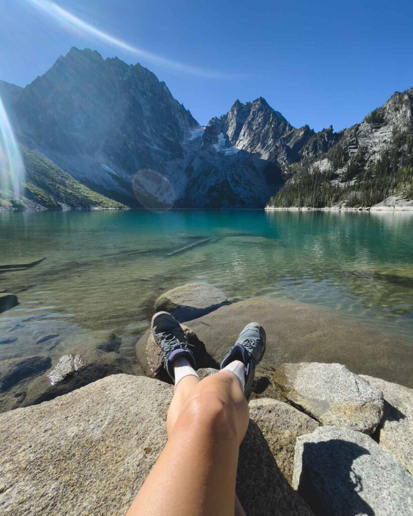
16. Colchuck Lake and Lake Stuart
Distance: 11.7 miles
Type of Trail: Out & Back
Difficulty: Hard
Pass: Northwest Forest Pass
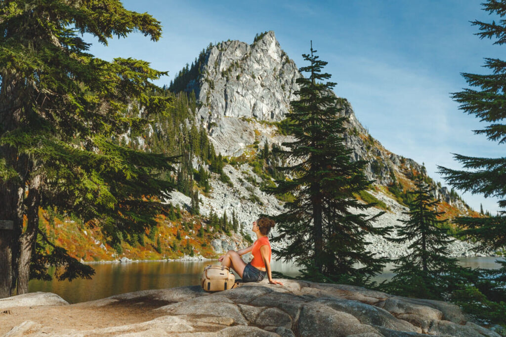
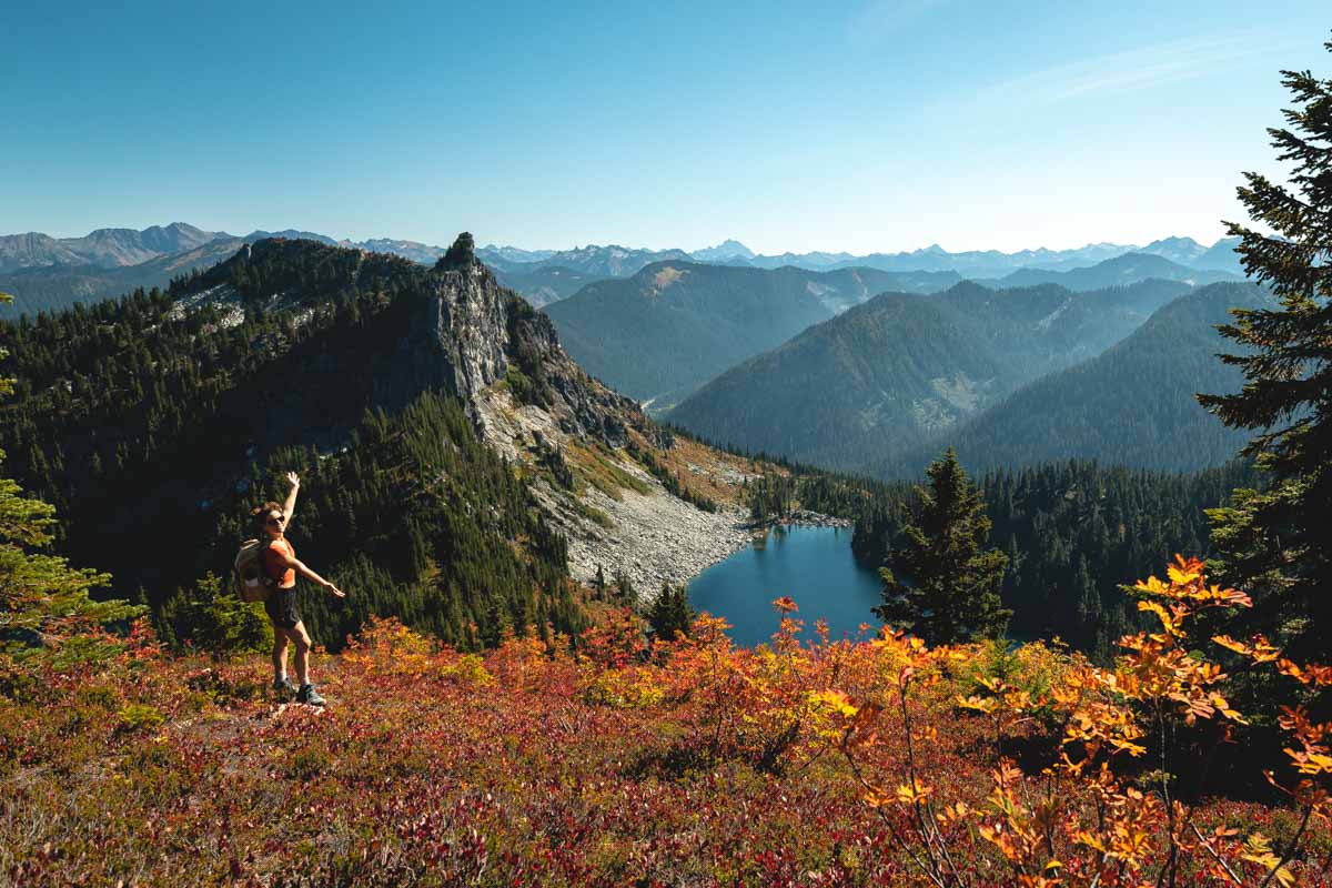
Situated in the aptly named Enchantment Mountain range, these two alpine lakes are an impossible shade of green you’ll simply have to see to believe.
Reaching them is no simple task, however. You’ll have to conquer a nearly 3,000-foot elevation gain, though most of the trail is blessed with a relatively gradual incline.
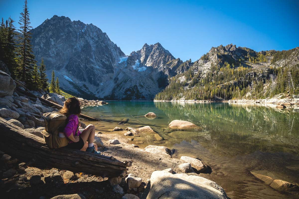
If you can, try to hit both lakes. If you only have time for one, Colchuck Lake is more picturesque, but you’ll have to scramble up steeper terrain to reach it.
Those who complete the journey will be rewarded with absolutely breathtaking views of unspoiled alpine scenery. If the weather is warm, feel free to brave a brisk dip in the lake!
BONUS: Don’t want this hike to end? Take on the Enchantments multi-day hike! You’ll need to get a permit to camp along the way OR be super fit and take on the 20-mile trek in one massive day.
READ MORE: Hiking The Colchuck Lake Trail + Lake Stuart!
Hikes in Washington’s Olympic National Park
Everyone entering Olympic National Park must pay an entrance fee. You can purchase a pass ahead of time or pay when you enter the park.
17. Rialto Beach to Hole-in-the-Wall Trail
Distance: 3.3
Type of Trail: Out & Back
Difficulty: Moderate
One of the most stunning coastal hiking trails in Washington is found on the rocky shores of Rialto Beach.
The trail is unique because it is most accessible during low tide, so be sure to check out the tide schedule on the day of your hike. Plan to come at low tide or at the least, within an hour or two before/after low tide.

You’ll hear the sound of waves crashing against the shore as you stroll across the sand, and the towering rock stacks and sun-bleached driftwood add to the dramatic forested backdrop. Finally, after about a mile of beach trekking, you’ll reach Hole in Wall.
This massive monolith features a picturesque tunnel created by the pounding of the waves.
After you cross through the hole, you’ll be spoiled with some epic tide pools that are worth exploring, and this is a popular area to catch a colorful beach sunset as well if the tides allow.
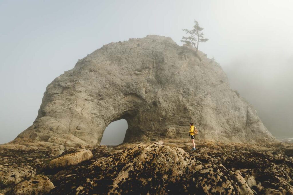
Be sure to wear supportive, waterproof shoes for this hike, as the rocks can be quite slippery. While this is a beach walk, it’s not a flip-flop kind of beach walk, trust us!
Wearing some shorts might be a good idea too, since you don’t want your pants getting wet when you’re near the water and tide pooling.
The Rialto Hole-in-The-Wall hike is definitely one of our top hikes in the state.
READ MORE: 15 Stunning Hikes in North Cascades National Park
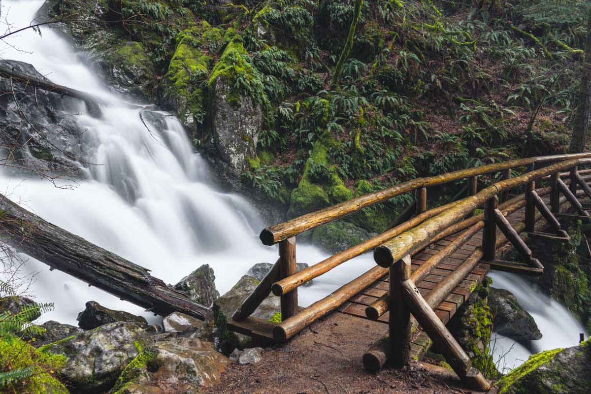
18. Sol Duc Falls via Lovers Lane Trail
Distance: 6.1 miles
Type of Trail: Loop
Difficulty: Moderate
Surrounded by 50 shades of green, Lovers Lane Trail is one of the best hikes in Washington.
This route is worlds away from the soaring mountain summits of some of the other iconic hiking trails in Washington. However, the peaceful surroundings and verdant fauna make this gem a must-see.
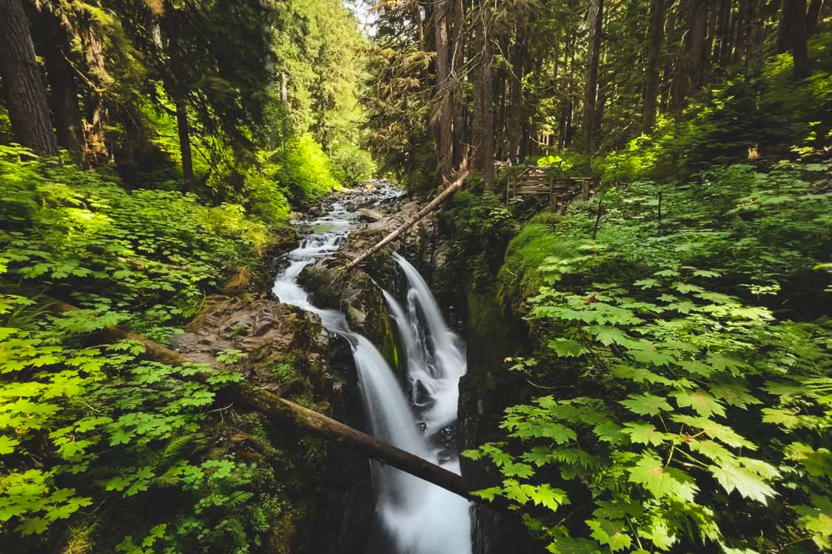
Situated inside of the lush Olympic National Park, the path meanders past the dazzling Sol Duc Falls, and when the sun shines through the towering trees you may understand why this trail is called Lovers Lane.
Rain or shine, wandering through the old-growth forest is a pleasant experience.
While there are some rocky sections and areas where tree roots protrude, the low elevation change makes it a fairly easy trip for hikers of all skill levels.
As a result, the trail is sometimes quite busy. However, you can beat the crowds by arriving early or hiking on a weekday.
The falls can be accessed through a shorter hike but we think this route is totally worth it.
The crowds pool at the falls but the rest of the route is empty and absolutely beautiful! Plus there are a few other smaller falls you’ll be able to enjoy along the way too.
READ MORE: Your Guide to Hiking The Sol Duc Falls Trail
19. Mount Storm King
Distance: 5.3 miles
Type of Trail: Out & Back
Difficulty: Hard
Don’t let the daunting name fool you. Mount Storm King is one of the best hiking trails in Washington. On the other hand, it is incredibly challenging, and only the most seasoned hikers should take on this route.
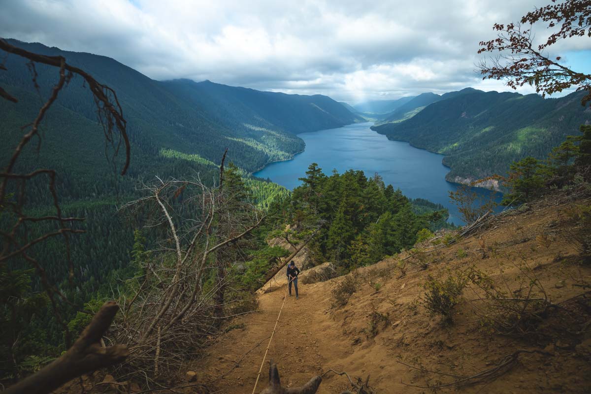
The elevation and switchbacks are part of what makes this trail a doozy, and your legs will likely be burning for much of the climb. If you have a fear of heights, consider turning back at the second lookout point.
However, the best views will be rewarded to the rebels who continue past the “End of Maintained Trail” sign. From here, you’ll come across an only slightly terrifying rope climb and then one last scramble up to the summit.
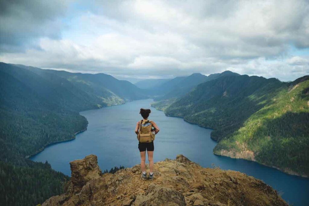
Those daring enough to reach the top will reap the rewards of their hard work – which come in the form of some seriously spectacular vistas.
It may not be easy, but Mount Storm King is undoubtedly one of the most rewarding hiking trails in Washington.
READ MORE: Mount Storm King Hike
GET THE ULTIMATE PNW MAP
Get our curated list of the best adventures, things to do, and places to grab a brew loaded onto your maps with just two clicks!
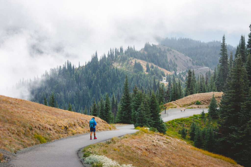
20. Hurricane Ridge Trail
Distance: 3.4 miles
Type of Trail: Out & Back
Difficulty: Moderate
Breathe in that fresh mountain air as you ascend one of Washington’s best hiking trails. Hurricane Ridge Trail is blessed with stunning views of the Olympic Range, Puget Sound, and Vancouver Island.
But it doesn’t stop there. This trail also boasts a fully paved trail, making it fully accessible for any and all hikers.
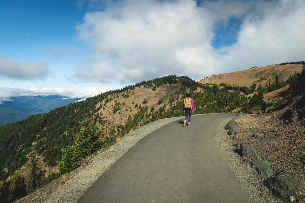
At just a few miles in length and an elevation change of fewer than 1,000 feet, you’ll get the epic views without having to navigate steep switchbacks or technical terrain.
That being said, this trail is named Hurricane Ridge for a reason. If you’re hiking during the off-season, the wind will make this moderate trail a bit more difficult.
The trail is at its most beautiful on clear sunny days when the wildflowers are in bloom. Consequently, the summer months are the busiest time to hike, so arrive early in the morning to beat the crowds.
BONUS: This is a popular trail and while totally worth it, if you want a lesser-visited trail nearby we LOVED the Switchback Trail. There are some truly gorgeous views from the top! You can easily do both of these on the same day if you’re an avid hiker.
READ MORE: Your Guide to Hurricane Ridge Trails
Washington Hikes in The North Cascades
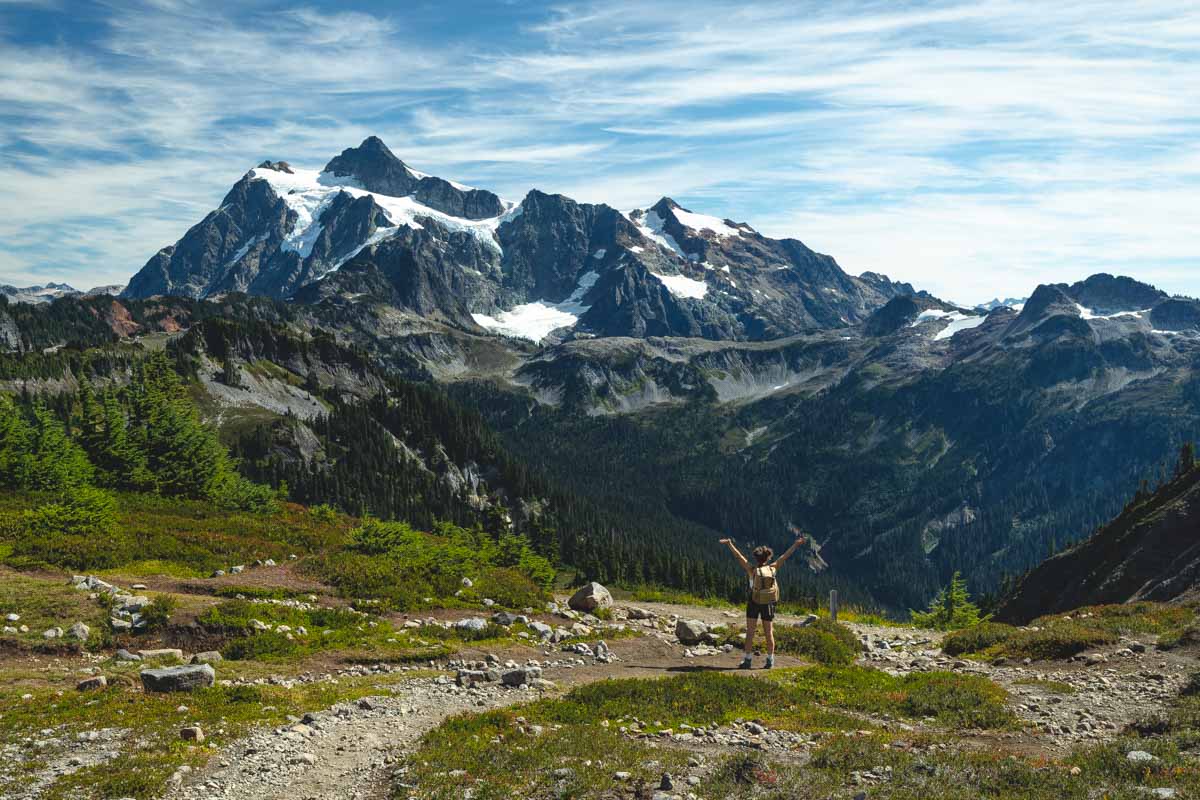
21. Chain Lakes Loop
Distance: 7.1 miles
Type of Trail: Loop
Difficulty: Moderate
Pass: Northwest Forest Pass
The North Cascades boasts some of the best hikes in Washington. The Chain Lakes Loop Trail is not to be missed if you’re visiting Mount Baker National Forest, especially between June and October.
You can begin your hike at the Artist Point trailhead or start a bit further back at the Austin Pass picnic area. Both trailheads are located off of Mount Baker Highway, which is subject to seasonal closures.
The trail winds its way around the rocky mountain with lots of ups and downs along the way. Therefore, sturdy shoes are highly recommended.
Whether you’re trekking clockwise or counter-clockwise, postcard-perfect views await you around every turn. Mount Shuksan, Mount Baker, and Glacier Peak are all standouts along this Washington hiking trail, and the glassy lakes and colorful valleys provide additional scenic views.
READ MORE: Hiking The Chain Lakes Loop
22. Maple Pass Loop
Distance: 6.6 miles
Type of Trail: Loop
Difficulty: Hard
Pass: Northwest Forest Pass
The Maple Pass Loop is the perfect hiking trail in Washington for those who want the bragging rights of conquering a challenging trek without the technical aspects that make other routes tricky.
You can expect a constant incline as you meander the trail, but it is gradual enough to be approachable for hikers of all skill levels.
If you’d like to get the hard part out of the way, take this trail clockwise. For a slow and steady approach, hiking counter-clockwise is a better bet.
If the climb doesn’t, the views will leave you breathless no matter which direction you are hiking. This is especially true in early October when the larches put on a spectacular color show.
The beginning of the trail is dotted with lush meadows of wildflowers. If you have the time, an easy detour to Lake Ann is worth it.
As you continue hiking, you’ll catch stellar views of Lake Ann from above, and the views of the Cascade Range are constant once you reach the rim.
Take your time soaking up the views once you reach Maple Pass, as the steep switchbacks on the way down will require your full attention.
RELATED: Hiking Maple Pass Trail
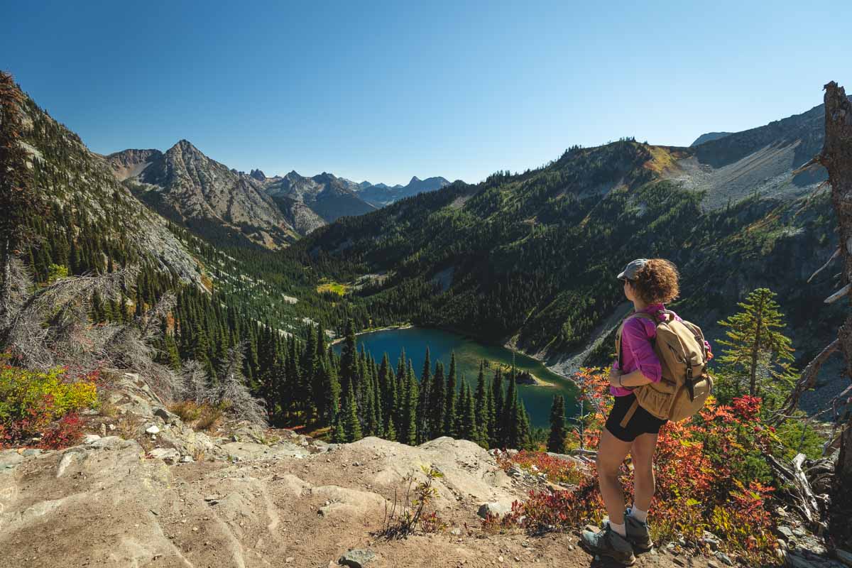
23. Blue Lake Trail
Distance: 4.6 miles
Type of Trail: Out & Back
Difficulty: Easy
Pass: Northwest Forest Pass
This is one of the best hikes in Washington for those who are short on time. The views will have you feeling like you’ve climbed high into the mountains when in reality, you’re trekking through a subalpine forest with less than a 1,000-foot elevation gain.
While the trail is not entirely effortless, the incline is very gradual. As the name suggests, the route will lead you to a lovely blue glacial lake with incredible mountain views to boot.
This forest hike is especially thrilling in the autumn, thanks to the golden hues of the larches that line the trail.
If you are hiking in the fall or winter, be sure to dress in layers and have sturdy footwear. Micro-spikes and poles are also recommended.
READ MORE: 15 Stunning Hikes in North Cascades National Park
Eastern Washington Trails
24. Palouse Falls
Distance: .2 miles
Type of Trail: Out and Back
Difficulty: Easy
Pass: Discovery Pass
This eastern Washington hiking trail is short and easy. However, if you take the side “trail” (almost literally just a dirt path), you’ll find that this route was made for only the most daring hikers, with steep scrambles, rocky drop-offs, and even the occasional rattlesnake.
Expect to get both your heart rate and adrenaline pumping on this challenging trek. Loose footwear and a fear of heights are not recommended. BUT you don’t have to go that route to get a good view!
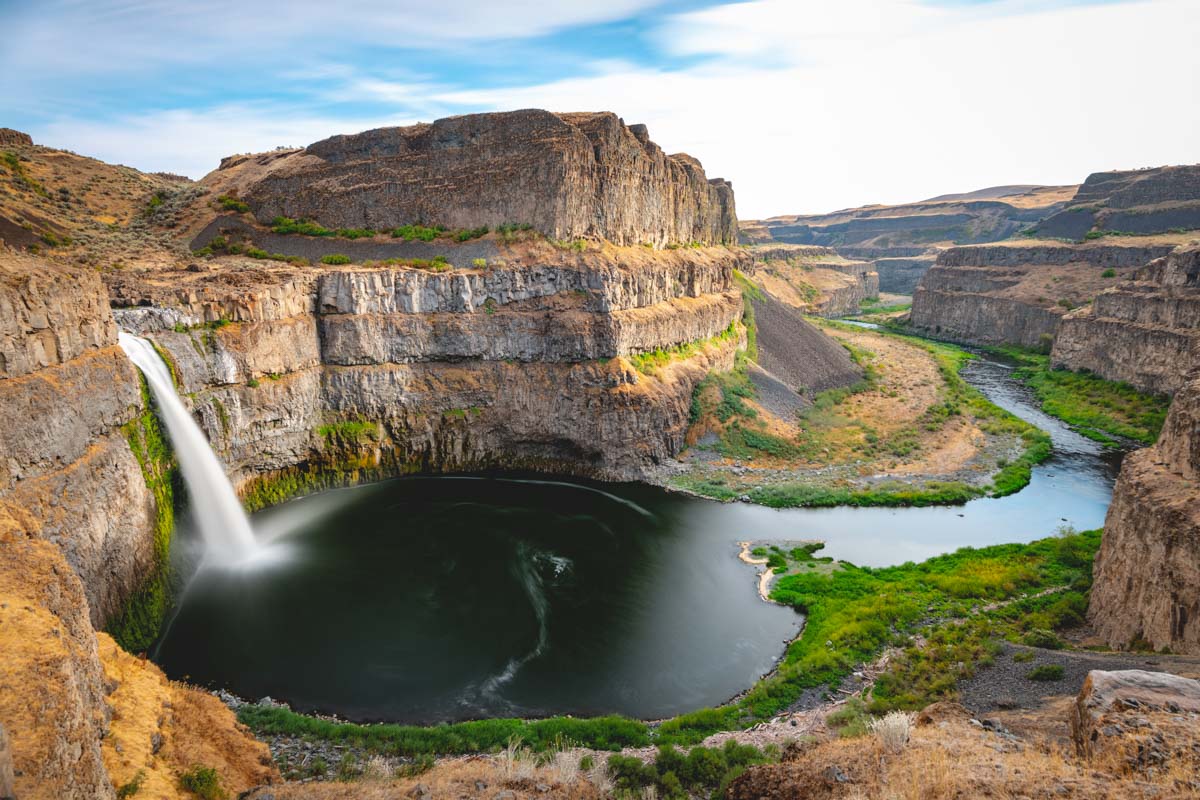
Those who decide to take on the easy “trail” will find impeccable views of the 198-foot Palouse Falls and the carved-out basalt cliffs surrounding it with barely any effort.
READ MORE: Palouse Falls State Park
25. Twin Sisters Rock
Distance: 0.6 miles
Type of Trail: Out & Back
Difficulty: Easy
Short and sweet with incredible views, Twin Sisters Rock Trail is easily one of the best hikes in Washington.
This flat desert route is a nice switch up from the exhausting mountain treks that the state is better known for, which might be why it is so sparsely trafficked.
However, anyone who has hiked the trail will know that this hidden gem is criminally underrated.

The path will lead you along Wallula Gap overlooking the Columbia River and finishes off at the Twin Sisters Rock formation. These basalt peaks date back to the last ice age and are well worth the short trek it takes to get to them.
This trail is great for hikers of all skill levels. Just beware of snakes!
Tips for Hiking in Washington
- If you’re taking on a few different hiking areas you might need 1-3 different passes! I know, confusing and weird, but don’t take a chance on getting fined. You’ll need a Northwest Pass, Washington Discovery Pass, and/or an America the Beautiful Pass (This one is for all 3 of the national park, or just get a week pass for a particular park if you aren’t going to all of them).
- Let’s say it together, friends, good hiking shoes are ESSENTIAL! The majority of these hikes will kill your feet if you go in with some crappy runners. Just get a pair of good hiking shoes that will last you years.
- We LOVE our Grayl water bottles. We don’t have to carry anything more than this bottle because we can fill up along the way as most of these hikes in Washington have running water nearby. We can fill up, filter, and drink all the water we need.
- Take into account the amount of driving needed to get around. This state is bigger than you think! Don’t start too late and caught out in the dark, or at the least make sure to carry a headlamp at all times.
- Always pack away your rain jacket. This is the PNW after all, and you DON’T want to get stuck out on a hike soaking wet. You can end up in a pretty bad situation. Pack a light one just in case.
Hiking in Washington is INCREDIBLE and we could have probably added 25 more if we’re being honest. BUT we hope this will kick-start you with some of our favorites around the state. Enjoy!