Yellow Aster Butte is named after a flower that isn’t there, and it’s still one of the best hard hikes in the North Cascades
Yellow Aster Butte has a naming problem. The yellow flowers carpeting its meadows aren’t asters at all — they’re daisies, and whoever named this North Cascades trail decades ago never got around to correcting it.
Nobody’s fixed it since. Get above treeline here and the ground opens into a plateau of tarns, meadows, and jagged summits — the view doesn’t seem to mind what you call the flowers.
Psst — we made you a West Coast Adventure Map. Nearly 1,900 of our favorite spots, already pinned, ready to load into Google Maps in two clicks — grab it here.
The numbers
This one’s hard — 8.4 miles round trip with 2,824 feet of elevation gain, according to AllTrails, and most hikers take five and a half to six hours to finish it. You’ll knock out almost half that climbing in the first mile and a half alone.
Worth showing up sore the next morning for? Every foot of it. But if your longest recent hike topped out around three miles, save this one until you’ve built up some legs under you.
📍 GET THE ULTIMATE PNW MAP 🗺️
Get our curated list of the best adventures, things to do, and places to grab a brew loaded onto your maps with just two clicks!
✅ Waterfalls ✅ Hikes ✅ Viewpoints
✅ Craft breweries ✅ National Parks ✅ 1400+ Pins


Getting there
The trailhead sits off Mount Baker Highway (SR 542), about 34 miles east of I-5 near the town of Glacier. Turn onto Twin Lakes Road (Forest Road 3065) and drive 4.5 miles of gravel to reach the Tomyhoi Lake/Yellow Aster Butte trailhead — a regular car can make it if you go slow, but the road turns rough enough to need high clearance if you keep driving past the trailhead itself.
You’ll need a Northwest Forest Pass to park here, since this is national forest land, not a state park or national park entrance. There’s no ranger station at the trailhead selling them, so grab one before you leave home.
Want something shorter in the same corridor? The Chain Lakes Loop near Artist Point covers similar high-country scenery in a gentler loop.
What the climb actually looks like
The trail starts climbing immediately and doesn’t let up — you’ll gain nearly 1,500 feet in the first mile and a half, switchbacking through an old avalanche path alongside hikers headed for Tomyhoi Lake. Past that junction, the trail flattens out and traverses south-facing meadows for close to two miles, which is finally where you get to enjoy the view instead of just your own breathing.
Indian paintbrush, lupine, heather, and fireweed fill those meadows through summer. Come fall, the same slopes turn orange and red instead.
Expect company — this is one of the more popular trails in the North Cascades, and the small trailhead lot fills early on clear weekends.
The payoff
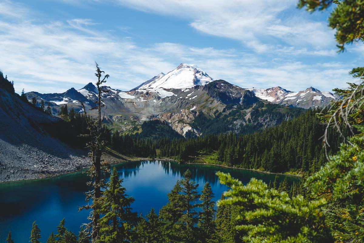
At the top, Mount Baker and Mount Shuksan dominate the skyline, with Tomyhoi Peak and Canada’s Border Peaks lined up behind them. Below, a scatter of alpine tarns reflects the whole scene right back at you.
If you’re staying overnight
Backpackers can camp near the tarns, about four miles in — not before, since the fragile meadows closer to the trailhead are off-limits to protect them. One more rule worth knowing: all human waste has to be packed out here, not buried, so plan accordingly.
Trip tips: grab a rental car to get out here, or lock in your hotel before the good rooms in Glacier and Maple Falls are gone.
Rules and fees change — always confirm current requirements before you go.