This 800-foot basalt island survived Washington’s biggest floods, and you can still hike to the top of it
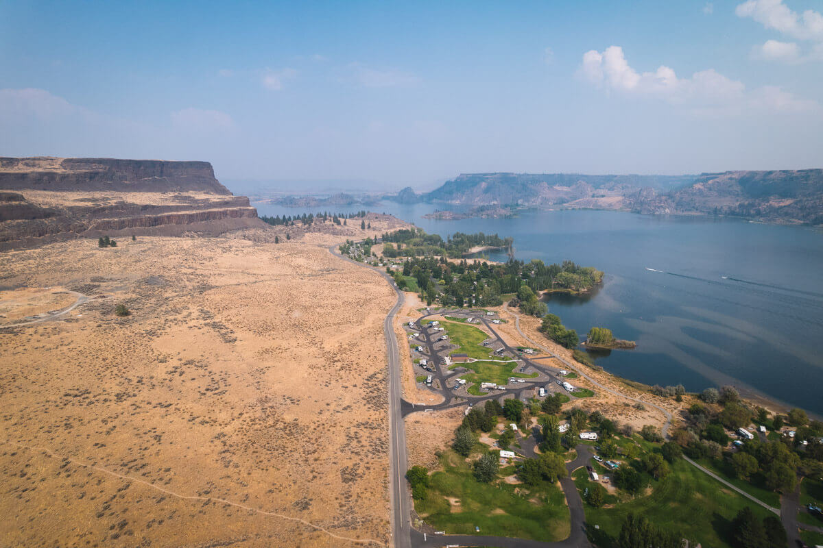
Steamboat Rock rises 800 feet straight out of Banks Lake, and when the Ice Age megafloods tore through this part of Washington, it was the one thing that didn’t move.
Floodwaters bigger than anything alive today scoured away everything soft around it, leaving this basalt butte standing alone as an island in the current. The water’s long gone. The rock’s still exactly where it stood.
Psst — we made you a West Coast Adventure Map. Nearly 1,900 of our favorite spots, already pinned, ready to load into Google Maps in two clicks — grab it here.
Floods that struck up to 100 times
The Missoula Floods weren’t a single event. Glacial Lake Missoula in Montana repeatedly burst through its ice dam and re-flooded this land, refilling and bursting again every few decades for thousands of years — as many as 100 times between about 18,000 and 13,000 years ago.
Each flood stripped the softer rock off the landscape and carved the canyons known today as the Channeled Scablands. Steamboat Rock’s hard basalt core just held firm through all of it, leaving a 600-acre plateau on top, flat enough to walk across, with cliffs dropping straight down on nearly every side.

📍 GET THE ULTIMATE PNW MAP 🗺️
Get our curated list of the best adventures, things to do, and places to grab a brew loaded onto your maps with just two clicks!
✅ Waterfalls ✅ Hikes ✅ Viewpoints
✅ Craft breweries ✅ National Parks ✅ 1400+ Pins


The lake around it isn’t natural, either
Banks Lake looks like it belongs here, but it’s a reservoir — dammed inside the same ancient coulee and filled with water pumped up from the Columbia River at Grand Coulee Dam.
The state park built around the rock covers 3,522 acres with 50,000 feet of freshwater shoreline, two campgrounds, a sandy swimming beach, and boat launches, all shaded by rows of tall poplars planted to cut the wind.
Hiking to the flat top
The full loop to the summit and back runs about 6 miles round trip with 650 feet of elevation gain, topping out at 2,250 feet. Washington Trails Association rates it moderate, and the steep, loose-rock climb up the draw at the start is the roughest stretch of the whole hike — after that, it levels into an easy stroll across the top.
At the fork near the summit, the trail splits into a north loop (about 3 miles) with cliffside views of Banks Lake and Grand Coulee, and a south loop (about 2.5 miles) with more lake and canyon views. A connector trail through the middle means you can do either one, or both. Go in spring and you’ll be walking through arrowleaf balsamroot and wildflowers most of the way up.
A Washington Discover Pass is required for parking here. If you’ve got time after, Washington Trails Association’s own advice is to head south to Sun Lakes-Dry Falls State Park — another Missoula Floods site, with an overlook of a canyon that once held a waterfall bigger than Niagara.
Trip tips: grab a rental car to get out here, lock in your hotel before the good rooms are gone, or skip both and book a camper van instead.
Rules and fees change — always confirm current requirements before you go.