
Washington’s Steptoe Butte is 400 million years older than the lava around it, and it gave geology a word used worldwide
Most hills don’t get a scientific term named after them. Steptoe Butte did — geologists everywhere now use “steptoe” for any isolated hill of older rock poking up out of a younger lava flow, and this one, rising out of the wheat country south of Spokane, is the reason why.
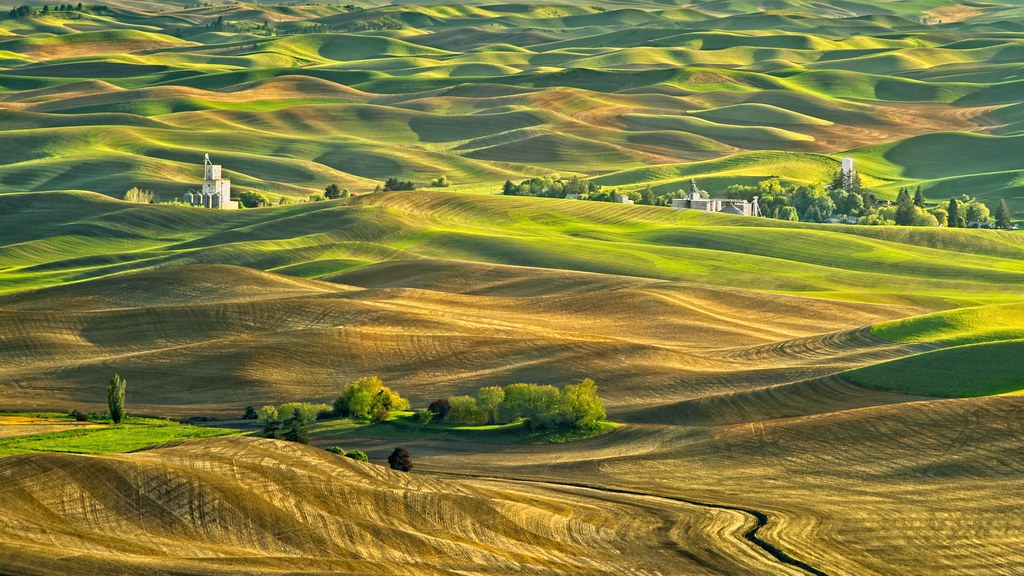
Stand on top and you get a full 360-degree view over the Palouse’s rolling hills, right now shifting from green toward gold as harvest gets underway. The butte itself predates all of it by a wide margin — its quartzite cap was laid down as seafloor sediment more than 400 million years ago, while the basalt flooding the plain around its base is a comparatively young 15 to 17 million years old.
Psst — we made you a West Coast Adventure Map. Nearly 1,900 of our favorite spots, already pinned, ready to load into Google Maps in two clicks — grab it here.
Why geologists borrowed this hill’s name
Steptoe Butte’s quartzite is so much older and harder than the Columbia River flood basalts that buried the land around it that erosion never managed to touch it. Millions of years later, the softer rock wore away and left the butte standing alone above the plateau — a landform geologists now call a “steptoe” wherever it happens again, anywhere in the world.
📍 GET THE ULTIMATE PNW MAP 🗺️
Get our curated list of the best adventures, things to do, and places to grab a brew loaded onto your maps with just two clicks!
✅ Waterfalls ✅ Hikes ✅ Viewpoints
✅ Craft breweries ✅ National Parks ✅ 1400+ Pins


The hotel that used to sit on top
In 1888, a settler named Cashup Davis hand-built a switchback road up the butte’s western slope using nothing but a horse, a scraper, and a pick and shovel, then opened a hotel on the summit with a dance floor and an observatory. On a clear day, guests could reportedly see all the way to Walla Walla and Mount Rainier through its telescope.
The hotel didn’t outlast its builder by much. It sat abandoned after Davis died in 1896, and two teenagers accidentally burned it to the ground in 1911 when a dropped cigarette caught the ruins on fire.
Getting to the summit
You don’t need to hike this one. A paved, four-mile road spirals around the butte to a parking lot right at the 3,612-foot summit — built in 1945, and it still crosses Cashup’s old wagon road in a few spots along the way.
It’s narrow and steep near the top, so use the pullouts and let faster traffic by. You can walk the road instead if you want the exercise — about 6.4 miles round trip with 925 feet of climbing, rated easy — but there’s no real reason to. Drive it, and save the legwork for a trail that actually asks something of you.
A Discover Pass covers parking, and there are vault restrooms partway up but none at the summit, so plan around that.
When to go
April through June gets you the green-and-gold patchwork hills that show up in every photo of this place. Right now, heading into August, the fields are turning solidly gold as harvest starts — a different look, but just as striking, especially at sunrise or sunset when the light comes in sideways across the hills.
A summit you can drive straight to, a hotel that’s been gone for over a century, and a word geologists use on the other side of the planet because of this one hill — how many viewpoints can say all three?
Trip tips: grab a rental car to get out here, lock in a hotel in Colfax or Pullman before harvest season books it up, or skip both and book a camper van instead.
Rules and fees change — always confirm current requirements before you go.