This central Washington desert canyon hides five lakes and a 100-foot waterfall, and the flood that carved it dwarfs anything happening today
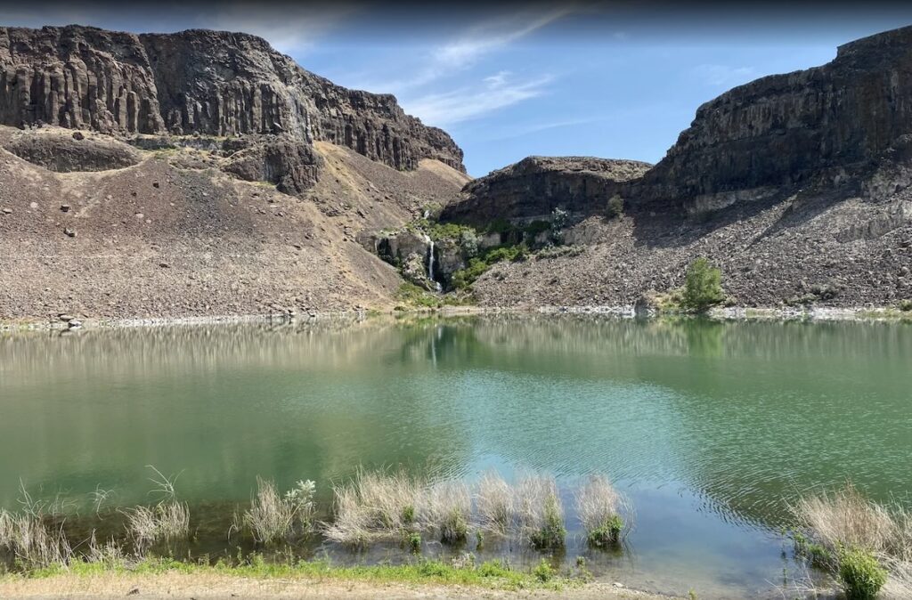
Nobody expects a waterfall in the middle of Washington’s driest, dustiest stretch of shrub-steppe. Ancient Lakes delivers one anyway — five turquoise lakes and a cascading, roughly 100-foot drop, tucked into a canyon that looks airlifted in from somewhere else entirely.
The whole scene sits inside Potholes Coulee, part of the Quincy Lakes Wildlife Area near the small farm town of Quincy. It’s roughly 9 miles from the Gorge Amphitheatre, so if you’ve ever camped out for a concert there, you’ve been closer to this than you probably realized.
Psst — we made you a West Coast Adventure Map. Nearly 1,900 of our favorite spots, already pinned, ready to load into Google Maps in two clicks — grab it here.
The hike itself
The Ancient Lakes Trail runs 4.6 miles round trip with about 295 feet of elevation gain, according to AllTrails — an easy loop most people finish in under two hours. There’s almost no shade anywhere on it, which matters more here than on nearly any other hike in this state.
The trail drops into a horseshoe-shaped canyon ringed by basalt cliffs, with the lakes strung along the bottom like stepping stones. Ancient Lake Falls tumbles down in stages over roughly 100 feet total, with its biggest single drop clearing 50 feet — not bad for a state better known for rain than desert waterfalls.
📍 GET THE ULTIMATE PNW MAP 🗺️
Get our curated list of the best adventures, things to do, and places to grab a brew loaded onto your maps with just two clicks!
✅ Waterfalls ✅ Hikes ✅ Viewpoints
✅ Craft breweries ✅ National Parks ✅ 1400+ Pins


Why a desert canyon has waterfalls at all
This landscape exists because of the Ice Age floods — catastrophic releases from Glacial Lake Missoula that tore across Washington at speeds up to 65 miles an hour, somewhere between 18,000 and 13,000 years ago. Potholes Coulee is what geologists call a recessional cataract canyon, one of the clearest examples in the state of floodwater eating backward through solid rock.
Geologist J Harlen Bretz spent decades studying canyons just like this one before anybody believed him — his flood theory was dismissed as outrageous for most of the early 20th century. He was right the whole time, and standing in this canyon is about as close as you can get to seeing his proof in person.
Honestly, it’s a more interesting geology lesson than most places that actually get a visitor center built around it.
What to know before you go
This is Washington Department of Fish and Wildlife land, so you’ll need a Discover Pass or a Vehicle Access Pass to park — not the pass you’d use at a national park or a national forest trailhead. Grab one ahead of time here. The main access road closes to vehicles from October 1 through March 1, though the trail itself stays open to hikers on foot year-round.
Pack in every drop of water you plan to drink — agricultural runoff means the lakes themselves aren’t safe to filter from. Between that and the total lack of shade, this is a hike best started early, especially once summer temperatures climb.
Want to turn it into an overnight? There are established backpack campsites scattered between the lakes, plus free dispersed vehicle camping at a few of the drive-in spots nearby. It’s an easy way to string together a night under genuinely dark desert sky and a sunrise hike the next morning.
Sunrise or sunset out here — which one do you think wins?
Trip tips: grab a rental car for the drive out to Quincy, lock in a hotel nearby if you’d rather sleep indoors, or skip both and bring a camper van for the dispersed sites near the lakes.
Rules and fees change — always confirm current requirements before you go.