The busiest trailhead near Seattle pulls 300,000 hikers a year, and it sits on a town Seattle itself flooded
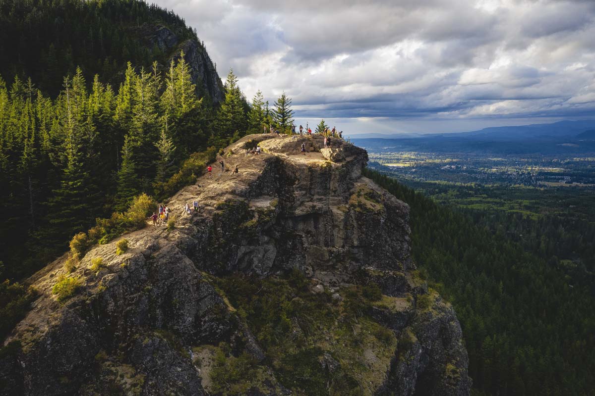
Washington built this trail expecting 70,000 visitors a year. It now pulls more than 300,000 — over four times the plan — and it’s still one of the best payoffs near Seattle for the effort involved.
Here’s the part almost nobody mentions at the top: the lake below the ledge is sitting where a town used to be. Seattle flooded it on purpose, condemned what was left, and burned the rest.
Psst — we made you a West Coast Adventure Map. Nearly 1,900 of our favorite spots, already pinned, ready to load into Google Maps in two clicks — grab it here.
A trail built for 70,000, now walked by 300,000
The Rattlesnake Ledge trail went in about twenty years ago, a joint project between the Washington Trails Association, the Mountains to Sound Greenway Trust, and Seattle Public Utilities, which still owns the land around the lake. Planners built it to handle roughly 70,000 hikers a year.
Seattle’s population didn’t cooperate. By 2022, WTA and KUOW were reporting more than 300,000 visitors annually, and the trail was showing it — eroded shoulders, widening switchbacks, hikers stepping off-path just to let others pass. A multi-year renovation widened the tread to a full five feet and re-graded the steepest sections.
📍 GET THE ULTIMATE PNW MAP 🗺️
Get our curated list of the best adventures, things to do, and places to grab a brew loaded onto your maps with just two clicks!
✅ Waterfalls ✅ Hikes ✅ Viewpoints
✅ Craft breweries ✅ National Parks ✅ 1400+ Pins


The lake used to be a town
Rattlesnake Lake didn’t exist until 1915. A railroad company town called Moncton sat on the prairie there, built in 1906 to house workers for the Chicago, Milwaukee and St. Paul Railroad and the crews building Seattle’s water and power system nearby.
When the city finished the Masonry Dam upstream that year, the water table rose and slowly drowned the town over one long summer. Seattle condemned what was left, paid residents just over $47,000 combined for their land, and a year later sent a crew to tear down the waterlogged buildings and burn them.
It’s not actually named for rattlesnakes
There aren’t any rattlesnakes at Rattlesnake Lake — never were, according to the Cedar River Watershed Education Center. The story goes that Arthur Denny, one of Seattle’s founders, heard a rattling sound in the prairie grass while exploring the area in the 1800s and assumed the worst. It was just dried seed pods rattling in the wind.
What the hike actually asks of you
From the main trailhead at Rattlesnake Lake, it’s 4 miles round trip to the ledge with about 1,160 feet of elevation gain — moderate, well-graded, and doable in half a day for most fitness levels. The junction sits at 1.9 miles; the ledge itself is about a hundred yards off to the right.
If the main ledge feels too crowded — and on a summer weekend, it usually is — Middle and Upper Ledge are a short scramble past the junction and noticeably quieter, with better sightlines back toward the crowds below. Ambitious hikers can keep going to East Peak, 2.4 miles past the junction, or the full ridge traverse to Snoqualmie Point Park, 8.3 miles out.
Getting there without losing an hour to the parking lot
The trailhead sits off I-90 exit 32, roughly 45 minutes from Seattle depending on traffic. No parking pass is required at the main Rattlesnake Lake lot — but the overflow lot near Snoqualmie Point Park, which doubles as the trailhead for the longer Rattlesnake Mountain Trail, sits on Washington DNR land and requires a Discover Pass.
Go early. The main lot fills fast on summer weekends, and once it does, people start parking along the road shoulder — legal within the white lines, but tight. Weekday mornings, ideally before 8 a.m., are the closest thing this trail has to solitude.
300,000 people a year can’t all be wrong about the view. The only real question is whether you’re willing to share it with a crowd, or show up early enough to have it mostly to yourself.
Trip tips: grab a rental car to reach the trailhead, or lock in a hotel nearby if you’re making a weekend of North Bend and Snoqualmie.
Rules and fees change — always confirm current requirements before you go.