One of the busiest WA hikes dead-ends at a boulder field, and the forest around it has been protected since 1947
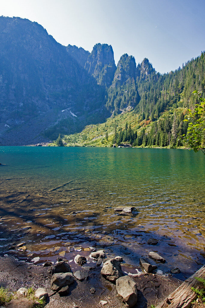
Lake 22 is one of the most-hiked trails on the Mountain Loop Highway, and almost everyone who reaches the end does the same thing: stand at the shoreline, stare across the water at the boulder field spilling down from Mount Pilchuck, and think about scrambling out onto it. Don’t. The official trail stops right there, and Washington Trails Association is blunt about why — that boulder field has cost hikers their lives.
Here’s what’s easy to miss in the rush to the water: the 790 acres surrounding the lake have been protected as a research natural area since 1947, off-limits to logging for almost eighty years now. That’s why the cedar and hemlock along this trail actually look like old growth — thick-trunked, moss-draped, the kind of trees that were already ancient when the first section of trail went in.
The hike itself runs 5.4 miles round trip with about 1,350 feet of elevation gain, rated moderate. It’s a real workout, but it’s short enough and well-built enough that Washington Trails Association lists it as good for kids. You’ll cross Twentytwo Creek on a bridge around the half-mile mark, then keep climbing through rainforest thick with ferns, salmonberry, and bleeding heart.
Around 1.5 miles the trees break for a talus slope, and if you’re hiking in summer, look for western columbine growing straight out of the rock. Whitehorse Mountain and Three Fingers show up on clear days from this stretch. It’s worth the pause before you’re back under tree cover.
The last stretch turns to wetland — skunk cabbage and all — before the trail crosses Lake 22’s outflow at 2.7 miles. Then there’s the lake itself: a still, glacier-carved cirque with Mount Pilchuck’s north face rising straight out of the far shore, waterfalls streaking down it, sometimes an avalanche rumbling through in winter and spring.
My honest take: skip the boulder field entirely. The view from the shoreline is the good one anyway, and it’s the one that doesn’t end with a rescue call.
You’ll need a Northwest Forest Pass or America the Beautiful pass to park here — this is national forest land, not a state park, so a Discover Pass won’t do you any good. The trailhead has a vault toilet and room for roughly 50 cars, and it fills up early on summer weekends.
To get there, take Highway 92 into Granite Falls, where the road becomes the Mountain Loop Highway. Stay on it for about 13 miles into Mt. Baker-Snoqualmie National Forest, and the trailhead turnoff is marked on the right, just past the bridge over Twentytwo Creek.
Trip tips: grab a rental car to get out here, or lock in a hotel nearby if you’re turning it into a full Mountain Loop weekend.
Rules and fees change — always confirm current requirements before you go.